
LiDAR remote sensing measures distance with light. It sends out laser pulses. It times how long each pulse takes to bounce back. LiDAR stands for Light Detection and Ranging. It is one of the most accurate tools in remote sensing today.
Here is a simple example. A drone flies over a forest. It uses LiDAR to map tree height. It can cover hundreds of acres in one flight.
✦ Most guides stop at “it measures distance with lasers.” But that misses the real point. LiDAR captures shape, not just distance. That is what makes 3D mapping possible.
In short, LiDAR turns light into a map. This matters more than it might sound. Traditional ground surveys take days or weeks to cover the same area. LiDAR can do it in hours. That speed is a big reason it spread so fast across mapping, forestry, and engineering fields.
LiDAR Full Form in Remote Sensing
LiDAR stands for Light Detection and Ranging. The name explains what it does. First, it detects light. Then, it uses that light to measure range. Range simply means distance. So the full form covers both halves of the process: detection and ranging.
What does LiDAR stand for in simple terms? LiDAR means using light to find objects. It also measures how far away those objects are.
Active vs Passive Remote Sensing
LiDAR is an active remote sensing system. Active systems make their own energy. They do not wait for sunlight.
Passive sensors work differently. A regular camera is passive. It only captures light that already exists.
LiDAR sends out its own laser light instead. Then it measures the light that bounces back. As a result, LiDAR can work at night. It does not need the sun at all.
✦ Many beginners assume all remote sensing needs sunlight. LiDAR breaks that rule completely. This is one reason it became so useful for night mapping and self-driving cars.
LiDAR is active. It sends out its own laser pulses. It does not depend on reflected sunlight.
Is LiDAR active or passive remote sensing?
How Does LiDAR Remote Sensing Work? Step-by-Step Process
LiDAR remote sensing works in a simple loop. It sends a pulse. It waits for the return. Then it turns that timing into distance. This loop repeats very fast. It can happen thousands of times each second. Over time, this builds a full 3D picture of an area.
According to NOAA, some airborne LiDAR systems fire hundreds of thousands of pulses per second during a single survey flight. That speed is what makes large-area mapping possible in just a few hours.
Step 1: Laser Pulse Emission
First, the system fires a laser pulse. The pulse travels toward the ground or another target. It moves in a straight line. Most systems use near-infrared light. Common wavelengths are 905 or 1550 nanometers. This choice balances safety and performance.
Step 2: Reflection Off a Target Surface
Next, the pulse hits something solid. This could be a building, a tree, or a road. Some of that light bounces back toward the sensor. Different surfaces reflect light in different ways. A rooftop gives a sharp, clean reflection. A tree canopy scatters the light across many leaves and branches instead.
Step 3: Time-of-Flight Measurement
Then, the sensor records the return time. This is called time of flight. The formula is simple: distance equals speed of light times time, divided by two. Since light speed never changes, this math stays highly accurate.
Step 4: Position Correction via GPS and IMU
However, raw distance alone is not enough. The system also needs to know its exact position in space. GPS tracks where the sensor is located. Meanwhile, an IMU tracks tilt, pitch, and rotation. IMU stands for Inertial Measurement Unit. Together, these two tools correct each laser return. This lines up every point with real-world coordinates.
Step 5: Point Cloud Generation
Finally, each corrected return becomes one point. Millions of these points combine to form a point cloud. A point cloud is a 3D map. It is built entirely from individual distance readings.
How does LiDAR remote sensing work in one sentence?
It fires laser pulses, times their return, and builds a 3D map called a point cloud.
Core Components of a LiDAR System
A LiDAR system relies on three main parts. These are the laser source, the scanner, and the positioning system. Each part plays its own role. Together, they produce accurate 3D data.
Laser Source and Wavelength Selection
The laser creates the pulses used for measurement. Wavelength choice affects both safety and performance. For example, many topographic systems use 1550nm lasers. This wavelength is safer for human eyes, even at higher power.
Scanner and Optics
The scanner steers the laser across an area. Without it, the sensor could only measure one straight line. Mirrors or rotating prisms usually handle this job. They move the beam quickly and with great precision.
GNSS/GPS and IMU Positioning
GNSS, often called GPS, tracks the sensor’s global location. The IMU tracks orientation and movement at the same time.
✦ Many beginners skip past this part. Yet GPS and IMU accuracy often matter more than the laser itself. A perfect laser reading is useless without a precise position to match it.
If you want a deeper breakdown of these platforms, see our guide to types of LiDAR systems.
Types of LiDAR in Remote Sensing
LiDAR in remote sensing comes in several types. Each type depends on where the sensor sits and how it collects data. Choosing the right type depends on scale, detail, and environment.
Airborne LiDAR
Airborne LiDAR sits on aircraft or drones. It is often used for large mapping projects, such as forestry or flood modeling. For example, county governments often use airborne LiDAR to update flood risk maps across entire watersheds.
Terrestrial and Mobile LiDAR
Terrestrial LiDAR sits on a tripod or a fixed ground point. It captures fine detail over small areas. Mobile LiDAR is different. It rides on a moving vehicle. It is widely used for road surveys and infrastructure inspection.
Spaceborne LiDAR
Spaceborne LiDAR operates from satellites. NASA’s ICESat-2 mission uses this method to track ice sheet elevation across the entire planet. This type covers huge areas. However, it usually captures fewer points per square meter than airborne systems.
Discrete-Return vs Full-Waveform LiDAR
Discrete-return LiDAR records only a few returns per pulse. Common examples are the first return and the last return. Full-waveform LiDAR works differently. It records the entire reflected signal. This captures more detail about vegetation structure.
✦ Full-waveform systems cost more. But they reveal internal canopy structure that discrete-return systems often miss entirely.
From Raw Data to Usable Output: Point Cloud Processing
Raw LiDAR data is not ready to use right away. It must be processed first. Processing turns scattered points into organized, classified information.
LiDAR remote sensing and applications now span many industries. These range from forestry to autonomous vehicles. Its ability to capture precise 3D structure makes it useful wherever accurate mapping matters.
This step is often skipped in beginner guides. Yet it is where most of the real work happens.
Point Classification (Ground, Vegetation, Buildings)
Classification sorts each point into a category. Common categories include ground, vegetation, and buildings. Software looks at height patterns and point density. Then it assigns labels automatically based on those patterns. For instance, a flat, low cluster of points is usually marked as ground. A tall, narrow cluster is often marked as a building.
DTM, DSM, and DEM: What’s the Difference
A Digital Terrain Model, or DTM, shows bare earth. It removes buildings and trees completely. A Digital Surface Model, or DSM, keeps everything. This includes trees, rooftops, and other surface features. A Digital Elevation Model, or DEM, is a broader term. It can mean either a DTM or a DSM, depending on context.
✦ Confusing DTM and DSM is one of the most common mistakes in early LiDAR projects. Using the wrong model can throw off flood or slope calculations by a wide margin.
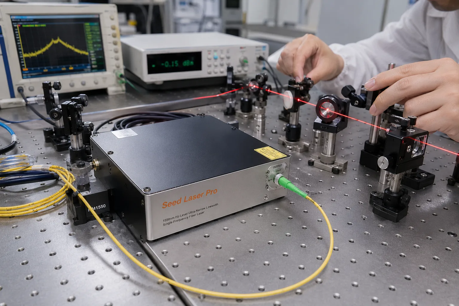
Working with your own LiDAR data? Seed Laser Pro helps you classify point clouds, generate DTM and DSM outputs, and clean up noisy returns without a steep learning curve. Try Seed Laser Pro to speed up your next survey.
LiDAR Remote Sensing and Applications
Topographic and Terrain Mapping
LiDAR creates highly accurate elevation maps. Engineers use these maps for construction planning and infrastructure design. For example, teams use LiDAR data to plan drainage, roads, and grading before construction even starts.
Forestry and Vegetation Analysis
LiDAR measures canopy height, density, and structure across large forest areas. This data works at a scale ground surveys cannot match. Researchers use it to estimate biomass. They also use it to track forest health over time.
Autonomous Vehicles and Robotics
Self-driving cars use LiDAR to detect obstacles. They also use it to measure distance in real time. As a result, vehicles can build a 3D view of their surroundings. This works even in low light, which cameras alone cannot handle well.
Coastal and Flood Risk Mapping
LiDAR helps model how water moves across land. This includes storm surges and rising sea levels. Government agencies often use this data to update flood zone maps. They also use it to plan coastal defenses. Beyond these core uses, LiDAR also supports mining, agriculture, and cultural heritage work. For example, archaeologists use LiDAR to find hidden structures under dense jungle canopy. This would take years to find using ground surveys alone. Utility companies also use LiDAR to inspect power lines. It helps them spot trees that grow too close to wires. This reduces fire risk in high-risk regions.
What is LiDAR used for in real life?
It is used in mapping, forestry, self-driving cars, flood modeling, and construction planning.
LiDAR vs Other Remote Sensing Methods
LiDAR differs from radar and photogrammetry in two key ways. These are the type of energy used and the accuracy achieved. Understanding these differences helps you pick the right tool for your project. For a full breakdown, see our comparison guide on LiDAR vs photogrammetry.
LiDAR vs Radar
Radar uses radio waves. LiDAR uses light instead. Radar covers longer range but offers lower resolution. Meanwhile, LiDAR offers finer detail. This makes it better suited for precise elevation and structure mapping.
LiDAR vs Photogrammetry
Photogrammetry builds 3D models from overlapping photos. It does not use laser pulses at all. LiDAR performs better in dense vegetation. This is because laser pulses can partially reach through small gaps in foliage. Photogrammetry struggles here, since it depends only on visible surfaces.
What is the difference between LiDAR and photogrammetry? LiDAR measures distance directly with laser pulses. Photogrammetry calculates 3D shape from multiple photographs instead.
Best Practices and Common Misconceptions in 2026
In 2026, most professionals treat LiDAR as one part of a larger workflow. It is rarely used alone anymore. Combining LiDAR with satellite imagery or photogrammetry is now common practice. This combination improves overall accuracy.
Why LiDAR Doesn’t Fully “See Through” Vegetation
LiDAR does not truly see through trees. It only receives partial returns through small gaps in the canopy. Dense forests can block most laser pulses. As a result, ground point density often drops sharply under heavy tree cover.
✦ This misconception leads many beginners to expect perfect ground data in thick forests. In reality, that ground data is often sparse and needs extra correction.
Choosing the Right LiDAR Platform for Your Project
Choose airborne LiDAR for large regional projects. Choose terrestrial or mobile LiDAR for detailed site-level work. Spaceborne LiDAR fits global-scale monitoring best. In that case, fine detail matters less than broad coverage.
Limitations and When LiDAR Isn’t the Right Choice
LiDAR is not ideal for every project. Cost, weather, and processing time can all limit its usefulness. Knowing these limits early helps you avoid wasted budget and unrealistic expectations.
Weather and Atmospheric Interference
Heavy rain, fog, and snow can scatter laser pulses. This reduces data accuracy significantly. Because of this, most professional surveys are planned around clear weather windows.
Cost and Processing Complexity
LiDAR equipment and data processing can be expensive. This is especially true compared to simpler imaging methods. Therefore, small projects with tight budgets sometimes choose photogrammetry instead. They accept lower accuracy in exchange for lower cost. Processing time is another factor to plan for. A single large survey can produce billions of points. Cleaning and classifying that much data takes real computing power and skilled staff. Many teams underestimate this step when they first plan a LiDAR project. There is also a learning curve involved. Reading point cloud data well takes practice. New users often need training before they can use the output with confidence.
Frequently Asked Questions
LiDAR stands for Light Detection and Ranging. It describes a system that uses light to detect objects and measure distance.
Modern airborne LiDAR can reach vertical accuracy within a few centimeters. This holds true under good survey conditions, based on USGS Lidar Base Specification standards.
Yes, LiDAR works well at night. It creates its own light source. However, heavy rain or fog can still reduce its accuracy.
LiDAR is active remote sensing. It sends out its own laser energy. It does not rely on natural light.
LiDAR measures distance directly with laser pulses. Photogrammetry estimates 3D shape from overlapping photographs instead.
Conclusion
LiDAR remote sensing turns light into detailed, accurate 3D maps. It follows a clear process: emit, reflect, time, correct, and build. From forestry to self-driving cars, its uses keep growing each year. Even so, it works best when paired with the right platform and a clear understanding of its limits. As sensors keep improving through 2026, LiDAR remains one of the most reliable tools in remote sensing. It is built for anyone who needs precise, real-world measurements.
Ready to put this into practice?
Seed Laser Pro gives you an easy way to process, classify, and visualize LiDAR point clouds, whether you’re mapping a forest, a coastline, or a construction site. Get started with Seed Laser Pro today.